Clearance CLR-5946 · SAF555
SAFELN
Safety & OperationsClearance sheet
El Niño Near Record Strength: What It Means for Winter Flying
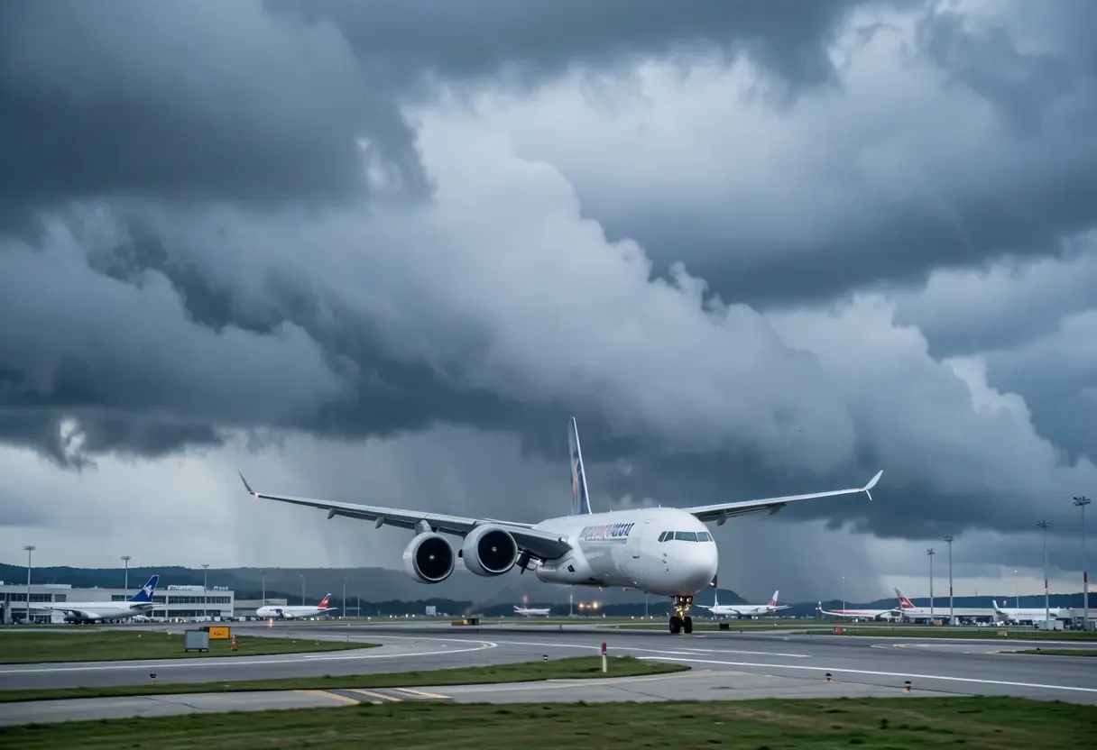
NOAA’s near-record El Niño points to rougher North Atlantic flights, stormier southern US hubs, windier UK airports and payload limits at Western Sydney.
Read-back
- NOAA’s preferred El Niño measure reached 2.0°C above normal in August-October 2026, 0.1°C below 1997.
- NOAA expects a strong to very strong El Niño through at least March 2027.
- OpenWeather analyses point to roughly 50% more turbulence in the worst-affected regions.
- A 2023 University of Reading study found severe clear-air turbulence rose from 17.7 to 27.4 hours annually between 1979 and 2020.
- ABC reported that an A380 at maximum weight would need payload cuts above 35°C at Western Sydney’s new airport.
Grace Kim
NOAA’s Climate Prediction Center, as reported by Watchers, said its preferred El Niño measure reached about 2.0°C, or 3.6°F, above normal for August through October 2026. That was the second-highest reading for that season since 1950, only 0.1°C below 1997, and NOAA expects a strong to very strong event through at least March 2027.
The Pacific has been running hotter than at almost any time since 1950, and public attention has followed. Google Trends recorded a 1,000% jump in US searches for “el niño weather,” exceeding 50,000 over two days, with related searches also trending in Canada and the UK.
For airlines, the forecast matters because El Niño shifts the jet stream for a season, rather than delivering one isolated storm. That changes routes, wind exposure, fuel requirements and the timing of disruption across several networks at once.
What could change over the North Atlantic?
OpenWeather says El Niño winters generally strengthen and extend the Pacific jet stream farther east, with the pattern carrying across North America and the Atlantic. A stronger, sharper jet produces more wind shear, the raw material for clear-air turbulence at cruising altitude. Such turbulence has no visible cloud, and weather radar does not show it.
OpenWeather says some analyses indicate roughly 50% more turbulence in the worst-affected regions during strong El Niño episodes, with the strongest signal along the transatlantic corridor. The company also notes that the strong 1997-98 event coincided with an unusually large spike in pilot turbulence reports. They indicate a risk pattern, not a forecast count of this winter’s disruptions.
A University of Reading study published in 2023 found that severe clear-air turbulence exposure at an average North Atlantic point rose from 17.7 hours in 1979 to 27.4 hours in 2020, a 55% increase. By 2020, the annual exposure exceeded one full day. The study’s lead author estimated that turbulence costs the industry $150m to $500m a year in the United States alone.
Airlines can route around the sharpest jet-stream sections, select different cruise levels and carry additional fuel for reroutes. They can also keep seatbelt signs on longer over known rough patches, a procedural mitigation rather than immunity. For passengers, the protection remains basic: keep the belt fastened whenever seated.
Where might US hubs absorb the impact?
AccuWeather’s winter outlook expects a stronger, more active southern storm track, with the most activity early in winter, according to Time Out’s report. The forecast divides the main US exposure into three broad areas.
- California: AccuWeather forecasts recurring atmospheric rivers that could begin in the state’s center and north before reaching Los Angeles and San Diego.
- Gulf Coast, south-central Plains and Southeast: AccuWeather expects persistent low pressure, severe weather and a risk of tornadoes across these regions.
- Atlanta, Dallas, Houston, Los Angeles and San Francisco: AccuWeather forecasts more active holiday weather around these busy US hubs.
AccuWeather expects the Northeast and Midwest to look calmer, with Philadelphia and Boston receiving less than half last winter’s snow. Its forecaster Paul Pastelok warned: “It only takes one storm to flip the script.”
The Department of Transportation says its automatic refund rule applies when an airline cancels a flight for any reason, including weather, and does not rebook the passenger. Accepting a voucher or rebooked flight forfeits that refund right. The protection concerns the ticket, not the cause of the cancellation.
What does a windy UK winter mean for operations?
The UK effect is less direct. The Met Office says El Niño can bring milder, wetter and windier weather to Britain in autumn and early winter, followed by colder, calmer spells in late winter. A windier opening period can mean more go-arounds, diversions and holding flights when crosswind limits tighten at exposed airports.
The same jet stream also changes transatlantic economics. A stronger flow speeds eastbound flights from North America and slows westbound services, according to OpenWeather. Shifts between headwinds and tailwinds can alter fuel burn by tonnes on one crossing, making wind forecast a direct schedule and fuel-cost variable.
How much heat can Australia absorb?
El Niño arrives during summer in the southern hemisphere. Australia’s Bureau of Meteorology says past events have been linked to drier, warmer conditions and warmer-than-average summers across large parts of the country. The bureau cautions: “Every El Niño is different,” and its strength does not always match local impact.
Heat also changes what an aircraft can carry. Hot air is less dense, reducing lift and engine thrust and lengthening takeoff runs. An aviation academic at UNSW recently told the ABC that an A380 at maximum weight would have to reduce payload to depart Western Sydney’s new airport above 35°C in light winds.
For airline planners, heat therefore becomes a payload constraint rather than merely a passenger-comfort issue. At the airport discussed by UNSW, the operating limit comes directly from performance in less dense air. The largest aircraft can still fly; it may simply carry less.
What should travelers watch?
Passengers should keep their seat belt fastened while seated, check the flight before leaving home and understand their refund rights before conditions deteriorate. The current forecast makes all three more likely to matter this winter.
For airlines, the watch through March 2027 covers rougher North Atlantic crossings, storm pressure on southern US hubs, wind restrictions in Britain and heat-driven payload limits in Australia. If NOAA’s forecast holds, the likely result is more bumps, disruption and payload constraints, not an industry shutdown.
via theaviationhub.co.uk (Source)
More from Grace Kim
Show full bio
News editor covering companies, deals and strategy in Commercial aviation industry coverage at Flightdeck Report.
640 articles
Same bay
- FDR339Air Cargo Carriers Warn of a Difficult Winter Ahead · October 13, 2026
- FDR259Canary Islands Wind Alert: 110 km/h Gusts Test Island Airports · November 10, 2026
- FDR717American Airlines Adds Three New Philadelphia–Europe Routes for Summer 2027 · September 30, 2026
- FDR949Southwest Airlines Files 11 New Routes for Summer 2027 · October 9, 2026
- FDR372KLM winter schedule restores Gulf routes and launches A350 on Toronto · October 9, 2026